Royal Kurgan, Kerch
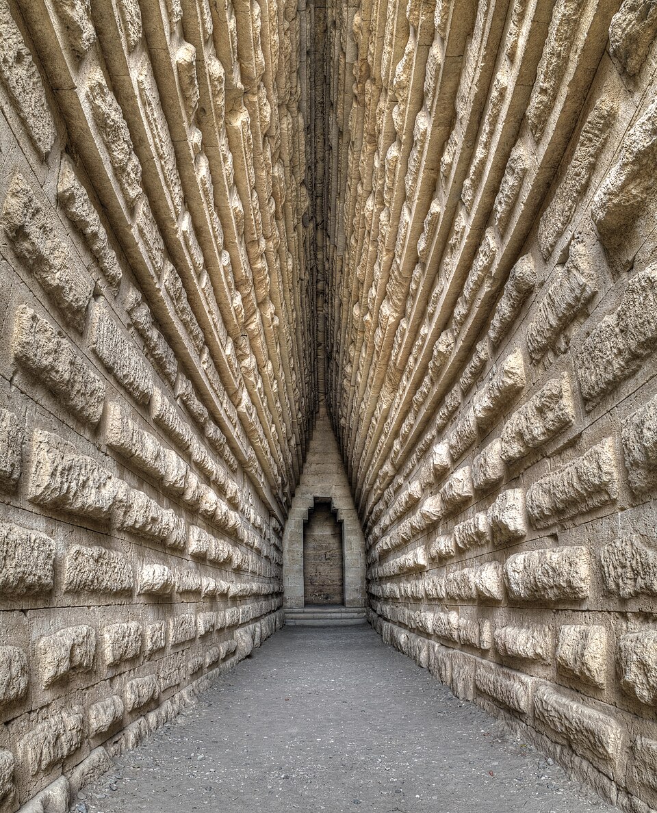

A 4th-century BC burial mound with a stone corridor (dromos) and a vault under a stepped dome — probably the tomb of a Bosporan ruler.
The mound near Kerch is dated to the 4th century BC (en.wikipedia; atlasobscura): almost 20 metres high and about 250 metres around the base. A corridor (dromos) 37 metres long and 2.8 metres wide leads to a square chamber of 4.39 × 4.35 metres under a stepped vault 8.84 metres high (en.wikipedia). It was excavated in 1833–1837, but only remains of a wooden sarcophagus were found — the tomb had been robbed in antiquity (en.wikipedia). It is believed to be the burial of a ruler of the Bosporan Kingdom, possibly Leukon I (389–349 BC); Christian symbols on the walls suggest that early Christians later hid here (en.wikipedia). The Royal Kurgan is a monument of national significance of Ukraine and a branch of the East Crimean reserve (Encyclopedia of Modern Ukraine). Crimea has been occupied since 2014; in August 2026 Suspilne reported at least six illegal archaeological expeditions by the occupiers on the peninsula.
Crimea has been occupied since 2014 — no access.